Everything But the Cheesesteak: Examine Philly’s Facets From Anywhere With NVIDIA GRID
OREANDA-NEWS. February 13, 2015. “Location, location, location” is the real estate mantra. When it comes to building-site selection, city evacuation planning or extracting natural resources, location is critical indeed.
To analyze location data, engineers, scientists, planners and developers rely on ArcGIS Pro software, from ESRI.
Geographic information system (GIS) software uses large data sets, especially for imagery and elevation features. With help from NVIDIA GRID technology, the ArcGIS Pro application and GIS data stay in the data center. Meanwhile, work crews and other users in the field get a workstation-class experience anywhere on the network, to any connected device.
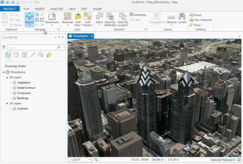
To get a taste of what that’s like, anyone, from any location, can now explore high-resolution imagery and buildings in downtown Philadelphia for free with NVIDIA GRID Test Drive.

From 10 feet off the ground to 10,000, you can examine the cityscape in incredible detail. It’s a digital recreation, so you set the parameters of your tour: Add and remove a single building—or all of them. Remove all overpasses and bridges. View Philly with or without vegetation.
The variety of views and building information gives you tons of flexibility.
Exploration to Go, With ArcGIS Pro
ESRI is the worldwide leader in desktop GIS software. Schools, governments and businesses create maps, visualize scenarios and share information with ESRI’s ArcGIS Pro. It’s a comprehensive set of tools that visualize, analyze, compile and share GIS data, in both 2D and 3D environments.
For example, Texas-based oil and gas company Legacy Reserves and the City of Waukesha, Wis., rely on ESRI ArcGIS applications and data to ensure their workers have remote access to applications while in the field.
Transitioning to a virtual desktop infrastructure with NVIDIA GRID has given their employees needed flexibility, with 24/7 access to data from any location or device. It’s also helped simplify their IT infrastructure deployments and maintenance. Each worker no longer needs a dedicated workstation, and help requests don’t usually require onsite visits.
It wasn’t always this way. Displaying and interacting with 3D data in a virtual environment historically has resulted in a poor user experience. That’s why we built NVIDIA GRID: virtualized GPUs that deliver rich graphics anywhere, without compromise in performance.
ESRI recently upgraded the graphics performance of ArcGIS Pro by embracing DirectX and OpenGL. With this move, ArcGIS Pro unburdens the CPU from graphics rendering and embraces GPUs, which excel at graphics.
ESRI demonstrated ArcGIS Pro running on GRID during its keynote presentation at the Federal GIS Conference in Washington on Feb. 9.
Anyone wishing to experience how ArcGIS Pro performs virtually can give it a try now that we’ve added it to NVIDIA GRID Test Drive. With a data set that uses a mix of 2D and 3D features, users anywhere can explore Philadelphia from different perspectives while discovering the visualization performance of GPUs in a virtual environment.
Just make sure you’ve had lunch before you get started.


Комментарии